Is the Caspian Sea salty? Why can the Caspian Sea be called neither a sea nor a lake? Seasonal changes at sea
The Caspian Sea is located between Asia and Europe. This is the largest salt sea-lake, located on the territory of Kazakhstan, Russia, Azerbaijan, Iran and Turkmenistan. Currently, its level is 28 meters below the level of the World Ocean. The depth of the Caspian Sea is quite large. The area of the reservoir is 371 thousand square kilometers.
Story
About five million years ago, the sea divided into small bodies of water, including the Black and Caspian Sea. After these events they united and separated. About two million years ago Caspian lake was cut off from the World Ocean. This period is considered the beginning of its formation. Throughout history, the reservoir has changed its contours several times, and the depth of the Caspian Sea has also changed.
Now the Caspian is the largest inland body of water, containing about 44% of the planet’s lake waters. Despite the changes taking place, the depth of the Caspian Sea did not change very much.
Once it was called Khvalian and Khazar, and the tribes of horse breeders gave it another name - Caspian. This is the name of the tribe living on the southwestern shore of the reservoir. In total, during its existence the lake had more than seventy names, here are some of them:
- Abeskunskoe.
- Derbent.
- Saraiskoe.
- Xihai.
- Dzhurdzhanskoe.
- Hyrcanian.
Depth and relief
The relief and features of the hydrological regime divide the sea-lake into northern, middle and southern parts. Over the entire area of the Caspian Sea, the depth is on average 180-200 m, but the relief in different parts different.
The northern part of the reservoir is shallow. Here the depth of the Caspian Sea-lake is approximately 25 meters. In the middle part of the Caspian there are very deep depressions, continental slopes, and shelves. Here the average depth is 192 meters, and in the Derbent depression - about 788 meters.
The greatest depth of the Caspian Sea is in the South Caspian depression (1025 meters). Its bottom is flat, and in the northern part of the depression there are several ridges. It is here that the maximum depth of the Caspian Sea is noted.

Coastline Features
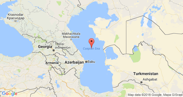
Its length is seven thousand kilometers. The northern part of the coastline is lowland, there are mountains on the south and west, and hills on the east. The spurs of Elbrus and the Caucasus Mountains approach the shores of the sea.
The Caspian has large bays: Kazakh, Kizlyar, Mangyshlak, Kara-Bogaz-Gol, Krasnovodsk.
If you go on a cruise from north to south, the length of the route will be 1200 kilometers. In this direction, the reservoir has an elongated shape, and from west to east the width of the sea is different. At its narrowest point it is 195 kilometers, and at its widest it is 435 kilometers. The average width of the reservoir is 315 km.
The sea has several peninsulas: Mangyshlak, Buzachi, Miankale and others. There are also several islands here. The largest are Chygyl, Kur-Dashi, Gum, Dash, and Tyuleni Islands.

Pond food
About one hundred and thirty rivers flow into the Caspian Sea. Most of them flow in the north and west. The main river flowing into the sea is the Volga. Approximately ninety percent of the volume of runoff comes from three large rivers: the Volga (80%), Kura (6%) and Ural (5%). Five percent are from Terek, Sulak and Samur, and the remaining four are brought by small rivers and streams of Iran.
Caspian resources
The reservoir has amazing beauty, diversity of ecosystems and richest reserve natural resources. When there are frosts in its northern part, magnolias and apricots bloom in the south.
Relict flora and fauna have been preserved in the Caspian Sea, including the largest school of sturgeon fish. As it evolves marine flora changed more than once, adapting to salinization and desalination. As a result, these waters became rich in freshwater species, but few in marine species.
After the Volga-Don Canal was built, new species of algae appeared in the reservoir, which were previously found in the Black and Azov Seas. Now in the Caspian Sea there are 854 species of animals, of which 79 are vertebrates, and over 500 species of plants. This unique sea-lake produces up to 80% of the catch of all sturgeon in the world and approximately 95% of the black caviar production.
Five species of sturgeon are found in the Caspian Sea: stellate sturgeon, thorn, sterlet, beluga and sturgeon. Beluga is the largest representative of the species. Its weight can reach a ton, and its length can be five meters. In addition to sturgeon, herring, salmon, kutum, roach, asp and other types of fish are caught in the sea.
Of the mammals in the Caspian Sea, only the local seal is found, which is not found in other bodies of water in the world. It is considered the smallest on the planet. Its weight is about a hundred kilograms, and its length is 160 centimeters. The Caspian region is a major route for bird migration between Asia, the Middle East and Europe. Every year, approximately 12 million birds fly over the sea during migration (south in spring and north in autumn). In addition, another 5 million remain in these places for the winter.

The most great wealth The Caspian Sea has huge reserves of oil and gas. Geological exploration in the region has discovered large deposits of these minerals. Their potential puts local reserves in second place in the world after
Caspian Sea short description endorheic salt lake of Eurasia and largest lake planets is described in this article. A message about the Caspian Sea will help you prepare for classes.
Caspian Sea: report
This water body is located at the geographical junction of Europe and Asia. The water level is 28 m below the level of the World Ocean. Over its long history, the Caspian Sea has “changed” more than 70 names. And yours modern name it received it from the ancient Caspian tribe, who were engaged in horse breeding and settled along the southwestern shore of the lake.
Salinity of the Caspian Sea not constant: near the mouth of the Volga River it is 0.05%, and in the southeast the figure increases to 13%. The area of the water body today is about 371,000 km2, the maximum depth of the Caspian Sea is 1025 m.
Features of the Caspian Sea
Scientists have conditionally divided the lake-sea into 3 natural zones:
- Northern
- Average
- Southern
Each of them has a different depth and composition of water. For example, the smallest part is Northern. The full-flowing Volga River flows here, so the salinity here is the lowest. And the southern part is the deepest, and, accordingly, salty.
The Caspian Sea was formed more than 10 million years ago. It can be called part of the ancient Tethys superocean, which once lay between the African, Indian and Eurasian continental plates. Its long history is also evidenced by the nature of the bottom and geological coastal deposits. The length of the coastline is 6500 - 6700 km, and including the islands up to 7000 km.
The shores of the Caspian Sea are predominantly smooth and low-lying. The northern part of the coastline is indented by islands and channels of the Ural and Volga deltas. The shore is swampy and low, covered with thickets. The eastern coast is characterized by limestone coasts that are adjacent to deserts and semi-deserts. The west and east coasts have winding coastlines.
Where does the Caspian Sea flow?
Since the Caspian Sea is an endorheic body of water, it is logical that it does not flow anywhere. But 130 rivers flow into it. The largest of them are Terek, Volga, Emba, Ural, Kura, Atrek, Samur.
Climate of the Caspian Sea
In the northern part of the sea the climate is continental, in the middle part it is temperate and in the southern part it is subtropical. in winter average temperature ranges from – 8 … – 10 ( Northern part) to +8 ... + 10 (southern part). Summer average temperatures range from +24 (northern part) to +27 (southern part). The maximum temperature recorded on the east coast was 44 degrees.
Animal and plant life
The fauna is diverse and includes 1809 species. The sea is home to 415 invertebrates and 101 species of fish. It concentrates most of world reserves of pike perch, sturgeon, roach, carp. The Caspian Sea is home to carp, mullet, bream, sprat, perch, kutum, pike, as well as such a large mammal as the Caspian seal.
The flora is represented by 728 species. The sea is dominated by diatoms, brown algae, red algae, blue-green algae, chara algae, ruppium and zoster.
The importance of the Caspian Sea
On its territory there are many gas and oil reserves, the fields of which are at the development stage. Scientists have calculated that oil resources amount to 10 billion tons, and gas condensate - 20 billion tons. The first oil well was drilled in 1820 on the Absheron shelf. Limestone, sand, salt, stone, and clay are also mined on its shelf.
In addition, the Caspian Sea is popular among tourists. Modern resort areas are being created on its banks, mineral water and dirt contribute to the development health complexes and sanatoriums. The most famous resorts- Amburan, Nardaran, Zagulba, Bilgah.
Environmental problems of the Caspian Sea
Sea waters are polluted as a result of the extraction and transportation of gas and oil on the shelf. Pollutants also come from the rivers that flow into it. Poaching of sturgeon caviar has led to a decrease in the number of these fish.
We hope that the report on the Caspian Sea helped you prepare for the lesson. You can supplement your essay on the Caspian Sea using the comment form below.
How the Caspian Sea came into being and its name
Since ancient times, the Caspian Sea has attracted the attention of people - both enlightened explorers, unenlightened conquerors, and merchants. What is the history of the Caspian Sea - the big lake in the world, what happened to the area occupied by the Caspian Sea for about two hundred million years?
Scientists have found that the Triassic period is the most early period the formation of a cooled mass of land - now the Caspian Sea spreads out in the form of a giant bay of some kind eastern ocean. This basin was located on the territory of the modern mountain ranges of the Caucasus, Pamir, Himalayas and Alps, and previously the huge Mediterranean Sea, called Tethys by geologists, stretched in a wide strip from Spain to Sunda archipelago. This is evidenced by finds of marine mollusks, characteristic of that period, in Transcaucasia and Kuban.
During the Jurassic period following the Triassic, which lasted approximately twenty-five million years, that is, as long as the Triassic, no significant changes occurred in the Caspian region, occupied, as before, by the sea basin.
During the second half of the Jurassic period and during the Cretaceous time, that is, for the next sixty million years, the Tethys Sea continues to encircle Europe and Asia. During this period, almost the entire European part of the USSR and Western Europe, previously representing land, is conquered by the water element.
At the beginning of the Cretaceous period in the waters of Tethys, huge layers of sediment - clayey silts, sands and limestones, accumulated over tens of millions of years due to compression of the earth's shell, began to swell, forming folds, and emerged from the water. Archipelagos of islands appeared. These were the first harbingers of one of the most powerful mountain-building cycles that engulfed our land a little later - in the Tertiary period, which, together with the Quaternary, makes up the Cenozoic era.
Scientists rightly assume that by the Tertiary period, a number of islands or one already existed on the site of the Main Caucasus Range big Island, gradually increasing due to the new rise of land.
In the early epoch of the Tertiary period, the entire south of the USSR was still flooded with the waters of Tethys. Among the water spaces in the form of islands were the Caucasus Range and Crimea. However, all the progressive mountain-building movements continued their struggle with the sea and raised more and more new land areas from the bottom. Around the middle of the Tertiary period (that is, in the Miocene era), the region now occupied by the Black and Caspian Seas separated from the Tethys mountain ranges that originated in the south. Over a wide area from Vienna to Aral Sea a closed basin was formed, called the Sarmatian Sea. This giant, desalinated by many rivers descending from the Russian Plain and Central Europe, was the ancestor of the modern Caspian Sea.
As a result of mountain-building processes, the Caucasian Island merged with the previously formed Transcaucasian land. From that moment on, the Black and Caspian Seas, which represented a single basin, were divided into two independent bodies of water, connected by a wide strait in the area of the Manych-Sal steppes.
In the second half of the Pliocene period, drained new areas, previously occupied by the sea, completely isolated the Caspian basin from the Black Sea. The area north of the Absheron Peninsula also turns into land. Only in the south does the large South Caspian Sea remain. Large rivers carried their waters here. big, high-water river- a distant ancestor of the Volga, descended from the north. From the west, the ancient Kura flowed into the lake, and from the east, a river that originated among the ridges of Central Asia and made its way into the Caspian Sea long before the legendary Uzboy.
At the end of the Pliocene period, the Caspian Sea again turned from a small closed basin into a vast sea, stretching from Iran to the city of Kuibyshev. This basin was again connected to the Black Sea by a narrow strait. This transformation occurred due to the immersion of large areas in the Middle and Northern Caspian Sea. Now in the area of the Absheron Peninsula, where the delta of the Paleo-Volga (that is, the ancient Volga) spilled among the sands, the deep Akchagyl Sea spread out.
Many thousands of years later, as a result of a strong contraction of the Akchagyl basin, a new basin appeared - the Absheron. Its outlines are very close to the modern Caspian Sea. This is how the history of the Caspian Sea developed until the turn of the Quaternary period, during which the ice age began on earth. Epochs of cooling were followed by eras of warming. During warming, snow began to melt, while cooling led to the expansion of the ice sheet. In the Caspian Sea, these changes caused level fluctuations. During thawing, the flow of meltwater increased, and during cooling it decreased. As a result, the Caspian Sea was twice connected to the Black Sea through a strait.
But the outlines of the Caspian Sea changed not only as a result of the influx of melt water. Its contours also changed due to the continued rise of the Caucasian mountain range. And now along the coast there are often traces of recent coastlines in the form of terraces, which indicate that even today the level of the Caspian Sea continues to fluctuate, although not to the same extent as in earlier eras.
This, in short, is the history of the emergence of the Caspian Sea.
No less interesting is the history of the origin of the name of the sea.
None of the seas of the globe, including the seas washing the shores of the historically most culturally and economically developed countries, did not have as many names as the Caspian Sea had.
In most cases, the Caspian Sea was named after states, principalities, regions located on its shores, or after the peoples inhabiting its coast, and sometimes according to real or imaginary properties.
Ignorance of the true nature of the Caspian Sea led to incorrect and sometimes fantastic ideas about it. There are no written documents left that could be used to establish the degree of knowledge of this sea by the peoples who lived on its shores in the era before the ancient explorers of Iran, Greece, Rome and others visited the Caspian countries.
The first name of the sea can be found in the sacred books of the Avesta, dated by various authors to approximately 1100–1200 BC. Thus, in the translation of one of the books of the Avesta, made by Wolf in 1910 from the Middle Pahlavi language into German, it says: “Like the sea Vouru Kasha is a gathering place of waters...”, where “Vouru Kasha”, according to the assumption of some scientists, means “vast pool” , “vast body of water.” By this they meant the current Caspian Sea, for the author of these verses, as researchers suggest, lived in Bactria, located in the southeast of the Caspian Sea.
It can be assumed that when the semi-legendary hero Homer in his poems speaks of the “pond of the sun”, where the daylight “goes to rest” every day, then by “pond of the sun” he means the area of the present Caspian Sea, that is, a place in the east of Greece and Asia Minor, where Homer lived.
According to Assyrian cuneiform inscriptions of the 8th–7th centuries BC - the first, famous researchers Documentary data - the sea was called Eastern.
The most common names of the sea in ancient reports are Hyrcanian, Ircanian - after the name of the region Hyrcania, which means “country of wolves”. The first name “Caspian,” as some researchers believe, was given to the sea by Herodotus, the great ancient historian and geographer, named after the Caspian peoples who once lived on its southwestern shore. Pliny Secundus called it Albanian in honor of the Albanian people. Horace Phlox - Stormy. Medieval writers Ibn Khordable, Ibn Yaqub - Jurdansky, Masudi Istakhri, Kazvini - Khazar; later, also by the names of the province, places, regions - Khvalyn, Saran, Khorosan, Tabaristan, Gilan, Derbent, Turkmen. One of the researchers studying this issue cites fifty-eight names given to the sea over many centuries by scientists, poets, and peoples. He believes that this, however, is not a complete list of its names. Only the beginning of the systematic hydrographic development of the sea established the name “Caspian”, which exists to this day.
From the book Empire - II [with illustrations] author10. How did the word “India” originate? So, in the XIV-XVI centuries, Western Europeans encountered oriental goods in Rus'. “Where from,” asked the Italian guests, delighted with the wonderful monkeys and ginger. “From India,” that is, from afar, from somewhere, they answered them in a businesslike manner
author Sitnikov Vitaly Pavlovich From the book Who's Who in World History author Sitnikov Vitaly Pavlovich From the book World War II. (Part II, volumes 3-4) author Churchill Winston SpencerChapter Fourteen American victories at sea. Coral Sea and Midway Island. Now on Pacific Ocean Exciting events took place that were reflected in the entire course of the war. By the end of March, the first stage of the Japanese war plan was crowned with such complete success that it
From the book Another History of Art. From the very beginning to the present day [with illustrations] author Zhabinsky Alexander From the book Lost Lands of Russia. From Peter I to Civil War[with illustrations] author Shirokorad Alexander BorisovichHow the Caspian Sea was a Russian lake for twenty years For the first time, the Rus - mixed detachments of Slavs and Varangians - appeared in the south of the Caspian Sea in 880. According to the Arab historian Ibn Isfendiyar, they attacked the city of Abaskun. Ibn Isfendiyar reports two more
From the book Calif Ivan author Nosovsky Gleb Vladimirovich10. How the name “India” came about So, let us repeat, in the 14th–16th centuries, Western merchants encountered eastern goods, mainly in Rus'. "Where?" - asked the Italian guests, delighted with the wonderful monkeys and ginger. “FROM INDIA”, that is, FROM A FAR, FROM SOMEWHERE -
From the book Book 2. The Rise of the Kingdom [Empire. Where did Marco Polo actually travel? Who are the Italian Etruscans? Ancient Egypt. Scandinavia. Rus'-Horde n author Nosovsky Gleb Vladimirovich10. How the name “India” arose So, in the XIV-XVI centuries, Western Europeans met with EASTERN goods IN Rus'. "Where?" - asked the Italian guests, delighted with the wonderful monkeys and ginger. “FROM INDIA,” that is, FROM A FAR, SOMEWHERE, they answered in a businesslike manner
From the book Russia: criticism of historical experience. Volume 1 author Akhiezer Alexander Samoilovich From the book Baptism of Rus' [Paganism and Christianity. The baptism of the Empire. Constantine the Great - Dmitry Donskoy. Battle of Kulikovo in the Bible. Sergius of Radonezh - image author Nosovsky Gleb Vladimirovich18. WESTERN SIBERIA AND THE CASPIAN SEA, see fig. p.13, fig. p.14, fig. p.19 ??? “The country of Great Siberia. There was a kingdom, but now it belongs to Russia. Sables, martens and foxes, beavers and squirrels, and many other animals will be born in it. The country is cold, there are a lot of forests in it.” See fig. p.13.??? “The Daurian country was for
From the book The Beginning of Russia author Shambarov Valery Evgenievich35. How the Kazan kingdom arose Vasily II was married for 7 years, but remained without offspring. Son Yuri was born and quickly died. This to a large extent fueled the ambitions of Dmitry Shemyaka. He felt like a rightful successor to the sovereign. It was possible to wait until the great
From the book History of Russian Investigation author Koshel Pyotr AgeevichHow the III Department arose Count Benckendorff in his notes explains the emergence of the institution entrusted to him: “Emperor Nicholas sought to eradicate the abuses that had crept into many parts of the administration, and was convinced of the suddenly discovered conspiracy that stained
From the book The Golden Age of Sea Robbery author Kopelev Dmitry NikolaevichCaspian Sea. 1572. But what happened to the English - agents of the Moscow company T. Banister and J. Dacket, sailing from Shirvan (Persia) to Astrakhan. “Due to constant changes in the wind and the dangerous shallow water of the Caspian Sea, they rushed across the sea near
From the book Roads of Millennia author Drachuk Viktor SemenovichHow writing arose Humanity did not know writing for most of its history. It went along long paths to it and only a few thousand years ago began to use signs to record speech. It is generally accepted that this happened about six thousand years ago, in
From the book The Influence of Sea Power on the French Revolution and Empire. 1793-1812 by Mahan AlfredChapter IX. Mediterranean in 1797 and 1798 – Bonaparte's Egyptian Expedition – Return of the British to the Mediterranean and the Battle of Abukir – Restoration of British dominance in the Mediterranean and formation of the second coalition Preliminary Peace of Leoben
From the book The Warsaw Ghetto no longer exists author Alekseev Valentin MikhailovichHOW THE WARSAW GHETTO ARISED How nice it is to finally have the opportunity to get into the skin of a Jew! Jews must feel that we are here... From the speech of Governor General Hans Frank at a meeting on November 25, 1939. One of the main elements of Hitler’s ideology
CASPIAN SEA (Caspian), the largest on globe closed reservoir, endorheic brackish lake. Located on the southern border of Asia and Europe, it washes the shores of Russia, Kazakhstan, Turkmenistan, Iran and Azerbaijan. Due to the size, originality natural conditions and the complexity of hydrological processes, the Caspian Sea is usually classified as a closed inland sea.
The Caspian Sea is located in a vast area of internal drainage and occupies a deep tectonic depression. The water level in the sea is about 27 m below the level of the World Ocean, the area is about 390 thousand km 2, the volume is about 78 thousand km 3. The greatest depth is 1025 m. With a width of 200 to 400 km, the sea extends along the meridian for 1030 km.
The largest bays: in the east - Mangyshlaksky, Kara-Bogaz-Gol, Turkmenbashi (Krasnovodsky), Turkmensky; in the west - Kizlyarsky, Agrakhansky, Kizilagaj, Baku Bay; in the south there are shallow lagoons. There are many islands in the Caspian Sea, but almost all of them are small, with a total area of less than 2 thousand km 2. In the northern part there are numerous small islands adjacent to the Volga delta; larger ones - Kulaly, Morskoy, Tyuleniy, Chechen. Off the western shores are the Absheron archipelago, to the south lie the islands of the Baku archipelago, east coast- a narrow island, stretched from north to south, Ogurchinsky.
The northern shores of the Caspian Sea are low-lying and very sloping, characterized by the widespread development of drying areas formed as a result of surge phenomena; deltaic shores are also developed here (deltas of the Volga, Ural, Terek) with an abundant supply of terrigenous material; the Volga delta with extensive reed thickets stands out. The western shores are abrasive, south of the Absheron Peninsula, mostly accumulative deltaic type with numerous bay bars and spits. Southern Shores low-lying. The eastern shores are mostly deserted and low-lying, composed of sand.
Relief and geological structure of the bottom.
The Caspian Sea is located in a zone of increased seismic activity. In the city of Krasnovodsk (now Turkmenbashi) in 1895, a powerful earthquake measuring 8.2 on the Richter scale occurred. On the islands and coast of the southern part of the sea, eruptions of mud volcanoes are often observed, leading to the formation of new shoals, banks and small islands, which are eroded by waves and appear again.

Based on the peculiarities of physical-geographical conditions and the nature of the bottom topography in the Caspian Sea, it is customary to distinguish the Northern, Middle and Southern Caspian Seas. The Northern Caspian Sea is distinguished by exceptionally shallow waters, located entirely within the shelf with average depths of 4-5 m. Even small changes in the level here on low-lying coasts lead to significant fluctuations in the area of the water surface, therefore the boundaries of the sea in the northeastern part are shown with a dotted line on small-scale maps. The greatest depths (about 20 m) are observed only near the conventional border with the Middle Caspian, which is drawn along a line connecting the island of Chechen (north of the Agrakhan Peninsula) with Cape Tyub-Karagan on the Mangyshlak Peninsula. The Derbent depression (maximum depth 788 m) stands out in the bottom topography of the Middle Caspian Sea. The border between the Middle and Southern Caspian Sea passes over the Absheron threshold with depths of up to 180 m along the line from Chilov Island (east of the Absheron Peninsula) to Cape Kuuli (Turkmenistan). The Southern Caspian basin is the most extensive area of the sea with the greatest depths; almost 2/3 of the waters of the Caspian Sea are concentrated here, 1/3 is in the Middle Caspian, and less than 1% of the Caspian waters are located in the Northern Caspian due to shallow depths. In general, the topography of the Caspian Sea bottom is dominated by shelf areas (the entire northern part and a wide strip along the eastern coast of the sea). The continental slope is most pronounced on the western slope of the Derbent Basin and almost along the entire perimeter of the South Caspian Basin. On the shelf, terrigenous-shelly sands, shell, and oolitic sands are common; deep-sea areas of the bottom are covered with siltstone and silty sediments with a high content of calcium carbonate. In some areas of the bottom, bedrock of Neogene age is exposed. Mirabilite accumulates in the Kara-Bogaz-Gol Bay.
 Tectonically, within the Northern Caspian Sea, the southern part of the Caspian syneclise of the Eastern European Platform is distinguished, which in the south is framed by the Astrakhan-Aktobe zone, composed of Devonian-Lower Permian carbonate rocks that lie on a volcanic base and contain large deposits of oil and natural combustible gas. From the southwest, Paleozoic folded formations of the Donetsk-Caspian zone (or Karpinsky ridge) are thrust onto the syneclise, which is a protrusion of the foundation of the young Scythian (in the west) and Turanian (in the east) platforms, which are separated at the bottom of the Caspian Sea by the Agrakhan-Guryev fault (left shear) of northeastern strike. The Middle Caspian mainly belongs to the Turanian platform, and its southwestern margin (including the Derbent depression) is a continuation of the Terek-Caspian foredeep of the fold system Greater Caucasus. The sedimentary cover of the platform and trough, composed of Jurassic and younger sediments, contains deposits of oil and combustible gas in local uplifts. The Absheron threshold, separating the Middle Caspian from the South, is a connecting link of the Cenozoic folded systems of the Greater Caucasus and Kopetdag. The South Caspian basin of the Caspian Sea with crust of oceanic or transitional type is filled with a thick (over 25 km) complex of Cenozoic sediments. Numerous large hydrocarbon deposits are concentrated in the South Caspian Basin.
Until the end of the Miocene, the Caspian Sea was a marginal sea of the ancient Tethys Ocean (from the Oligocene - the relict oceanic basin of the Paratethys). By the beginning of the Pliocene, it lost contact with the Black Sea. The Northern and Middle Caspian Seas were drained, and the paleo-Volga valley stretched through them, the delta of which was located in the area of the Absheron Peninsula. Delta sediments have become the main reservoir of oil and natural combustible gas deposits in Azerbaijan and Turkmenistan. In the late Pliocene, in connection with the Akchagyl transgression, the area of the Caspian Sea greatly increased and the connection with the World Ocean was temporarily resumed. The waters of the sea covered not only the bottom of the modern depression of the Caspian Sea, but also the adjacent territories. In Quaternary time, transgressions (Apsheron, Baku, Khazar, Khvalyn) alternated with regressions. The southern half of the Caspian Sea is located in a zone of increased seismic activity.
Climate. The Caspian Sea, strongly elongated from north to south, is located within several climatic zones. In the northern part the climate is temperate continental, on the west coast it is warm temperate, southwestern and south coast lie within the subtropics; the east coast is dominated by a desert climate. IN winter time over the Northern and Middle Caspian, the weather is formed under the influence of Arctic continental and sea air, and the Southern Caspian is often under the influence of southern cyclones. The weather in the west is unstable and rainy, in the east it is dry. In summer, the western and northwestern regions are influenced by the spurs of the Azores atmospheric maximum, and the southeastern ones are influenced by the Iran-Afghan minimum, which together creates dry, stable warm weather. Over the sea, winds prevail in the northern and northwestern (up to 40%) and southeastern (about 35%) directions. average speed winds about 6 m/s, in central regions sea up to 7 m/s, in the area of the Absheron Peninsula - 8-9 m/s. Northern storm “Baku Nords” reach speeds of 20-25 m/s. Lowest average monthly temperatures Air temperatures of -10 °C are observed in January - February in the northeastern regions (in the most severe winters they reach -30 °C), in the southern regions 8-12 °C. In July - August, average monthly temperatures over the entire sea area are 25-26 °C, with a maximum of 44 °C on the east coast. The distribution of atmospheric precipitation is very uneven - from 100 mm per year on the eastern shores to 1700 mm in Lankaran. The open sea receives an average of about 200 mm of precipitation per year.
Hydrological regime. Changes in the water balance of an enclosed sea greatly influence changes in the volume of water and corresponding fluctuations in level. Average long-term components of the water balance of the Caspian Sea for the 1900-90s (km 3 /cm layer): river runoff 300/77, precipitation 77/20, underground runoff 4/1, evaporation 377/97, runoff to Kara-Bogaz- Gol 13/3, which forms a negative water balance of 9 km 3, or 3 cm of layer, per year. According to paleogeographic data, over the past 2000 years, the range of fluctuations in the level of the Caspian Sea has reached at least 7 m. Since the beginning of the 20th century, level fluctuations have shown a steady downward trend, as a result of which over 75 years the level dropped by 3.2 m and in 1977 reached -29 m (lowest position in the last 500 years). The sea surface area has decreased by more than 40 thousand km 2, which exceeds the area of the Sea of Azov. Since 1978, a rapid rise in level began, and by 1996 a mark of about -27 m relative to the level of the World Ocean was reached. In the modern era, fluctuations in the level of the Caspian Sea are determined mainly by fluctuations in climatic characteristics. Seasonal fluctuations in the level of the Caspian Sea are associated with the unevenness of river flow (primarily the Volga runoff), therefore the lowest level is observed in winter, the highest in summer. Short-term sharp changes in level are associated with surge phenomena; they are most pronounced in shallow northern areas and during storm surges can reach 3-4 m. Such surges cause flooding of large coastal areas of land. In the Middle and Southern Caspian Sea, surge fluctuations in level average 10-30 cm, under storm conditions - up to 1.5 m. The frequency of surges, depending on the region, is from one to 5 times a month, lasting up to one day. In the Caspian Sea, as in any closed body of water, seiche level fluctuations are observed in the form of standing waves with periods of 4-9 hours (wind) and 12 hours (tidal). The magnitude of seiche vibrations usually does not exceed 20-30 cm.
River flow in the Caspian Sea is distributed extremely unevenly. More than 130 rivers flow into the sea, which on average bring about 290 km 3 of fresh water per year. Up to 85% of the river flow falls on the Volga and the Urals and enters the shallow Northern Caspian Sea. Rivers west coast- Kura, Samur, Sulak, Terek, etc. - provide up to 10% of the flow. Another approximately 5% of fresh water is brought to the South Caspian by rivers on the Iranian coast. The eastern desert shores are completely deprived of constant fresh flow.
The average speed of wind currents is 15-20 cm/s, the highest - up to 70 cm/s. In the Northern Caspian Sea, the prevailing winds create a flow directed along the northwestern coast to the southwest. In the Middle Caspian, this current merges with the western branch of the local cyclonic circulation and continues to move along the western coast. Near the Absheron Peninsula the current bifurcates. Its part in the open sea flows into the cyclonic circulation of the Middle Caspian, and the coastal part goes around the shores of the Southern Caspian and turns north, joining the coastal current that goes around the entire eastern coast. The average state of movement of Caspian surface waters is often disturbed due to variability in wind conditions and other factors. Thus, in the northeastern shallow area, a local anticyclonic gyre may arise. Two anticyclonic eddies are often observed in the Southern Caspian Sea. In the Middle Caspian in the warm season, stable northwest winds create southerly transport along the eastern coast. In light winds and during calm weather, currents may have other directions.
 Wind waves develop very strongly, since the prevailing winds have a long acceleration length. Unrest develops mainly in the northwestern and southeast directions. Strong storms are observed in the open waters of the Middle Caspian Sea, in the areas of Makhachkala, the Absheron Peninsula and the Mangyshlak Peninsula. Average height waves of greatest frequency are 1-1.5 m, at wind speeds of more than 15 m/s it increases to 2-3 m. The highest wave heights are recorded during strong storms in the area of the Neftyanye Kamni hydrometeorological station: annually 7-8 m, in some cases up to 10 m .
The water temperature on the sea surface in January - February in the Northern Caspian Sea is close to freezing temperature (about -0.2 - -0.3 °C) and gradually increases in south direction up to 11 °C off the coast of Iran. In summer, surface waters warm up to 23-28 °C everywhere, except for the eastern shelf of the Middle Caspian Sea, where in July - August seasonal coastal upwelling develops and the surface water temperature drops to 12-17 °C. In winter, due to intense convective mixing, the water temperature changes little with depth. In summer, under the upper heated layer at horizons of 20-30 m, a seasonal thermocline (a layer of sharp temperature changes) is formed, separating deep cold waters from warm surface ones. In the bottom layers of waters of deep-sea depressions all year round The temperature remains 4.5-5.5 °C in the Middle Caspian and 5.8-6.5 °C in the Southern Caspian. Salinity in the Caspian Sea is almost 3 times lower than in open areas of the World Ocean, averaging 12.8-12.9‰. It should be especially emphasized that the salt composition Caspian water is not completely identical to the composition of ocean waters, which is explained by the isolation of the sea from the ocean. The waters of the Caspian Sea are poorer in sodium salts and chlorides, but richer in carbonates and sulfates of calcium and magnesium due to the unique composition of salts entering the sea with river and underground runoff. The highest salinity variability is observed in the Northern Caspian, where in the estuarine areas of the Volga and Ural the water is fresh (less than 1‰), and as we move south, the salt content increases to 10-11‰ at the border with the Middle Caspian. The greatest horizontal salinity gradients are characteristic of the frontal zone between marine and river waters. The differences in salinity between the Middle and Southern Caspian Seas are small; salinity increases slightly from northwest to southeast, reaching 13.6‰ in the Turkmen Gulf (in Kara-Bogaz-Gol up to 300‰). Vertical changes in salinity are small and rarely exceed 0.3‰, which indicates good vertical mixing water Water transparency varies widely from 0.2 m in estuarine areas large rivers up to 15-17 m in the central regions of the sea.
According to the ice regime, the Caspian Sea is classified as a partially frozen sea. Ice conditions are observed annually only in the northern regions. The Northern Caspian is completely covered by sea ice, the Middle Caspian is partially covered (only in severe winters). Middle border sea ice runs along an arc convex to the north, from the Agrakhan Peninsula in the west to the Tyub-Karagan Peninsula in the east. Ice formation usually begins in mid-November in the extreme northeast and gradually spreads to the southwest. In January, the entire Northern Caspian Sea is covered with ice, mostly fast ice (immobile). Drifting ice borders the fast ice with a strip 20-30 km wide. Average ice thickness from 30 cm southern border up to 60 cm in the northeastern regions of the Northern Caspian Sea, in hummocky accumulations - up to 1.5 m. The destruction of the ice cover begins in the 2nd half of February. In severe winters, drifting ice is carried south, along the western coast, sometimes to the Absheron Peninsula. At the beginning of April, the sea is completely free of ice cover.
History of the study. It is believed that the modern name of the Caspian Sea comes from the ancient Caspian tribes who inhabited the coastal areas in the 1st millennium BC; other historical names: Hyrkan (Irkan), Persian, Khazar, Khvalyn (Khvalis), Khorezm, Derbent. The first mention of the existence of the Caspian Sea dates back to the 5th century BC. Herodotus was one of the first to claim that this body of water is isolated, that is, it is a lake. In the works of Arab scientists of the Middle Ages there is information that in the 13th-16th centuries the Amu Darya partially flowed into this sea through one of its branches. The well-known numerous ancient Greek, Arabic, European, including Russian, maps of the Caspian Sea until the beginning of the 18th century did not reflect reality and were actually arbitrary drawings. By order of Tsar Peter I, in 1714-15, an expedition was organized under the leadership of A. Bekovich-Cherkassky, who explored the Caspian Sea, in particular its eastern shores. The first map, on which the contours of the coasts are close to modern ones, was compiled in 1720 using astronomical definitions by Russian military hydrographers F.I. Soimonov and K. Verdun. In 1731, Soimonov published the first atlas, and soon the first printed sailing guide of the Caspian Sea. A new edition of maps of the Caspian Sea with corrections and additions was carried out by Admiral A.I. Nagaev in 1760. The first information on the geology and biology of the Caspian Sea was published by S. G. Gmelin and P. S. Pallas. Hydrographic research in the 2nd half of the 18th century was continued by I.V. Tokmachev, M.I. Voinovich, and at the beginning of the 19th century by A.E. Kolodkin, who was the first to carry out instrumental compass surveying of the coast. Published in 1807 new map Caspian Sea, compiled taking into account the latest inventories. In 1837, systematic instrumental observations of sea level fluctuations began in Baku. The first was completed in 1847 Full description Gulf of Kara-Bogaz-Gol. In 1878, a General Map of the Caspian Sea was published, which reflected the results of the latest astronomical observations, hydrographic surveys and depth measurements. In 1866, 1904, 1912-13, 1914-15, under the leadership of N. M. Knipovich, expeditionary research was carried out on the hydrology and hydrobiology of the Caspian Sea; in 1934, the Commission for the Comprehensive Study of the Caspian Sea was created at the USSR Academy of Sciences. A great contribution to the study of the geological structure and oil content of the Absheron Peninsula and the geological history of the Caspian Sea was made by Soviet geologists I. M. Gubkin, D. V. and V. D. Golubyatnikovs, P. A. Pravoslavlev, V. P. Baturin, S. A . Kovalevsky; in the study of water balance and sea level fluctuations - B. A. Appolov, V. V. Valedinsky, K. P. Voskresensky, L.S. Berg. After the Great Patriotic War, systematic, comprehensive research was launched in the Caspian Sea, aimed at studying the hydrometeorological regime, biological conditions and geological structure of the sea.
In the 21st century in Russia, two large scientific centers are engaged in solving the problems of the Caspian Sea. Caspian Marine Research Center (CaspMNRC), created in 1995 by government decree Russian Federation, conducts research work in hydrometeorology, oceanography and ecology. The Caspian Research Institute of Fisheries (CaspNIRKH) traces its history back to the Astrakhan Research Station [established in 1897, since 1930 the Volga-Caspian Scientific Fisheries Station, since 1948 the Caspian Branch of the All-Russian Research Institute of Fisheries and Oceanography, since 1954 the Caspian Research Institute of Marine Fisheries and Oceanography (CaspNIRO), modern name since 1965]. CaspNIRH is developing the fundamentals of conservation and rational use biological resources Caspian Sea. It consists of 18 laboratories and scientific departments - in Astrakhan, Volgograd and Makhachkala. It has a scientific fleet of more than 20 vessels.
Economic use. Natural resources The Caspian Sea is rich and varied. Significant hydrocarbon reserves are being actively developed by Russian, Kazakh, Azerbaijani and Turkmen oil and gas companies. There are huge reserves of mineral self-sedimented salts in the Kara-Bogaz-Gol Bay. The Caspian region is also known as a massive habitat for waterfowl and semi-aquatic birds. About 6 million migratory birds migrate across the Caspian Sea every year. In this regard, the Volga delta, Kyzylagaj, Northern Cheleken and Turkmenbashi bays are recognized as sites of international rank within the framework of the Ramsar Convention. The mouth areas of many rivers flowing into the sea have unique types of vegetation. The fauna of the Caspian Sea is represented by 1800 species of animals, of which 415 are vertebrate species. More than 100 species of fish live in the sea and river mouths. They have commercial significance marine species- herring, sprat, gobies, sturgeon; freshwater - carp, perch; Arctic “invaders” - salmon, whitefish. Major ports: Astrakhan, Makhachkala in Russia; Aktau, Atyrau in Kazakhstan; Turkmenbashi in Turkmenistan; Bender-Torkemen, Bender-Anzeli in Iran; Baku in Azerbaijan.
Ecological state. The Caspian Sea is under powerful anthropogenic influence due to the intensive development of hydrocarbon deposits and the active development of fishing. In the 1980s, the Caspian Sea provided up to 80% of the world's sturgeon catch. Predatory fishing in recent decades, poaching and a sharp deterioration of the environmental situation have brought many valuable fish species to the brink of extinction. The living conditions of not only fish, but also birds and sea animals (Caspian seal) have deteriorated. Countries washed by the waters of the Caspian Sea are faced with the problem of creating a set of international measures to prevent pollution of the aquatic environment and developing the most effective environmental strategy for the near future. A stable ecological state is observed only in parts of the sea remote from the coast.
Lit.: Caspian Sea. M., 1969; Comprehensive studies of the Caspian Sea. M., 1970. Issue. 1; Gul K.K., Lappalainen T.N., Polushkin V.A. Caspian Sea. M., 1970; Zalogin B.S., Kosarev A.N. Seas. M., 1999; International tectonic map of the Caspian Sea and its frame / Ed. V. E. Khain, N. A. Bogdanov. M., 2003; Zonn I. S. Caspian Encyclopedia. M., 2004.
M. G. Deev; V. E. Khain (geological structure of the bottom).
Many geographical names, can mislead people who are not keen on geography. Could it be that an object designated as a sea on all maps is actually a lake? Let's figure it out.
The history of the appearance of the Caspian Sea?
14,000,000 years ago, the Sarmatian Sea existed on the planet. It included modern, Black, Caspian and Sea of Azov. About 6,000,000 years ago, due to the rise of the Caucasus Mountains and the decrease in water levels in the Mediterranean Sea, it divided, forming four different seas.
The Caspian is inhabited by many representatives of the fauna of Azov, which once again confirms that these reservoirs were once one whole. This is one of the reasons why the Caspian Sea is considered a lake.
The name of the sea comes from the ancient tribes of the Caspian Sea. They inhabited its shores in the first millennia BC and were engaged in horse breeding. But over the many hundreds of years of its existence, this sea has had many names. It was called Derbentsky, Saraisky, Girkansky, Sigai, Kukkuz. Even in our time, for residents of Iran and Azerbaijan, this lake is called Khazar.
Geographical location
Two parts of the world - Europe and Asia - are washed by the waters of the Caspian Sea. Coastline covers the following countries:
- Turkmenistan
- Russia
- Azerbaijan
- Kazakhstan
The length from north to south is about one thousand two hundred kilometers, the width from west to east is about three hundred kilometers. The average depth is about two hundred meters, the greatest depth is about a thousand kilometers. total area The reservoir covers more than 370,000 square kilometers and is divided into three climatic and geographical zones:
- Northern
- Average
- Southern Caspian
The water area includes six large peninsulas and about fifty islands. Their total area is four hundred square kilometers. The most large islands– Dzhambaisky, Ogurchinsky, Chechen, Tyuleniy, Konevsky, Zyudev and Absheron Islands. About one hundred and thirty rivers flow into the Caspian Sea, including the Volga, Ural, Atrek, Sefirud, Terek, Kura and many others.
Sea or lake?
The official name used in documentation and cartography is the Caspian Sea. But is this true?
In order to have the right to be called a sea, any body of water must be connected to the world's oceans. In the case of the Caspian Sea, this is not reality. The Caspian Sea is separated by almost 500 km of land from the nearest sea, the Black Sea. This is a completely enclosed body of water. The main differences between the seas:
- The seas can be fed by waterways - rivers.
- The external seas are directly connected to the ocean, that is, they have access to it.
- Inland seas are connected to other seas or oceans by straits.
The Caspian received the right to be called a sea primarily because of its impressive size, which is more typical of seas rather than lakes. In area it surpasses even Azov. Also no small role was played by the fact that not a single lake washes the shores of five states at once.
It is worth noting that the structure of the Caspian Sea bottom is of the oceanic type. This happened due to the fact that it was once part of the ancient World Ocean.
Compared to other seas, the percentage of salt saturation in it is very weak and does not exceed 0.05%. The Caspian Sea is fed only by rivers flowing into it, like all lakes on the globe.
Like many seas, the Caspian is famous for its powerful storms. The height of the waves can reach eleven meters. Storms can occur at any time of the year, but they are most dangerous in autumn and winter.
In fact, the Caspian Sea is the most big lake in the world. Its waters are not subject to international maritime laws. The territory of waters is divided between countries on the basis of laws adopted for lakes, and not for seas.
The Caspian Sea has rich mineral resources such as oil and gas. Its waters are inhabited by more than one hundred and twenty species of fish. Among them are the most valuable sturgeons, such as stellate sturgeon, sturgeon, sterlet, beluga, and thorn. 90% of the world's sturgeon catch comes from the Caspian Sea.
Interesting features:
- Scientists around the world have not yet come to a clear conclusion as to why the Caspian Sea is considered a lake. Some experts even suggest considering it a “lake-sea” or an “inland” sea, like the Dead Sea in Israel;
- The most deep point Caspian Sea - more than one kilometer;
- Historically, it is known that the total water level in the reservoir has changed more than once. The exact reasons for this are still not understood;
- It is the only body of water separating Asia and Europe;
- The largest water artery feeding the lake is the Volga River. It is this that carries the bulk of the water;
- Thousands of years ago the Caspian Sea was part of the Black Sea;
- In terms of the number of fish species, the Caspian Sea is inferior to some rivers;
- The Caspian Sea is the main supplier of the most expensive delicacy - black caviar;
- The water in the lake is completely renewed every two hundred and fifty years;
- Japanese territory less area Caspian Sea.
Ecological situation
Intervention into the ecology of the Caspian Sea regularly occurs due to the extraction of oil and natural resources. There are also interventions in the fauna of the reservoir, cases of poaching and illegal fishing of valuable fish species are frequent.
The water level in the Caspian Sea is falling every year. This is due to global warming, due to the influence of which the water temperature on the surface of the reservoir increased by one degree and the sea began to actively evaporate.
It is estimated that water levels have fallen by seven centimeters since 1996. By 2015, the level of the fall was about one and a half meters, and the water continues to fall.
If this continues, in a century the shallowest part of the lake may simply disappear. This will be the part that washes the borders of Russia and Kazakhstan. If global warming intensifies, the process may accelerate and this will happen much earlier.
It is known that long before the onset of global warming, the water level in the Caspian Sea underwent changes. The water kept rising and then falling. Scientists still cannot say exactly why this happened.